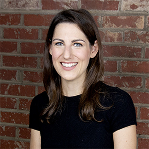
Clio Andris is an assistant professor of urban analytics in the School of City and Regional Planning and the School of Interactive Computing at Georgia Tech. Her background is GIS and her research is on mathematical models of social networks, social flows, and interpersonal relationships in geographic space applied to issues of urban planning, information visualization, and geography. She directs the Friendly Cities Lab: Data-driven love for community. She is a member of the Georgia Tech Center for Spatial Planning Analytics and Visualization (CSPAV) and an affiliate of the Center for Quality Growth and Regional Development (CQGRD). She is also a member of the School of Interactive Computing's Information Visualization research group.
Daniel Block is a professor of geography at Chicago State University and an adjunct professor of preventive medicine at Northwestern University. He has completed many food access studies, including the Northeastern Illinois Community Food Security Assessment, a large-scale food access study of the six-county Chicago metro area. He is author or co-author of several articles on the regulation and gendering of milk in the early twentieth century, foodways of the urban poor, and the book Chicago: A Food Biography. Much of his work focuses on community-university partnerships for food justice. He is a past president of the Agriculture, Food, and Human Values Society, is currently on the board of the Association for the Study of Food and Society, and is a fellow of the Association of American Geographers. He currently is a board member of the Chicago Food Policy Action Council, through which he working with a team to develop an interactive food environment map of the Chicago area. He is also currently part of a team comparing the regulation of street food vendors in Chicago, Bangkok, Hanoi, and Montpellier, France. He received his PhD from UCLA where he studied the history of milk regulation in Chicago and the US.


Dr. Jayajit Chakraborty is a Professor of Geography in the Department of Sociology and Anthropology and the Founding Director of the Socio-Environmental and Geospatial Analysis Lab at the University of Texas at El Paso. His research interests encompass hazards geography, health geography, and urban geography. He is particularly interested in the applications of GIScience and spatial statistical techniques for analyzing environmental and social justice issues. Dr. Chakraborty has authored more than 100 publications and recently co-edited The Routledge Handbook of Environmental Justice. His research activities have been funded by the US National Science Foundation, Environmental Protection Agency, Florida Department of Transportation, University of Texas System, and several other agencies. Dr. Chakraborty has chaired the American Association of Geographers Awards Committee and the Hazards, Risks, and Disasters Specialty Group. He is currently serving on the editorial boards of Environmental Justice and International Journal of Environmental Research and Public Health.
Dr. Xiang Chen is an Assistant Professor in the Department of Geography at the University of Connecticut, USA. He earned a Ph.D. in geography at The Ohio State University. With training in Geographic Information Systems (GIS) and transportation modeling, Dr. Chen has applied emerging geospatial technologies (e.g., deep-learning, geovisualization) to community health issues, including food security, obesity, and epidemics. He also has expertise in mathematical modeling of infectious diseases and their vectors. His recent projects establish a mechanistic model for dengue vector and develop a mathematic model for COVID-19 by considering social distancing metrics. These threads of research have led to about 40 peer-review articles in quality geography and public health journals, including International Journal of Geographical Information Science, Remote Sensing of Environment, American Journal of Public Health, Obesity Reviews, and Parasite and Vectors.
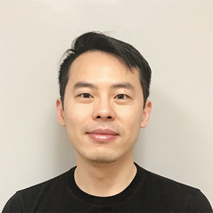
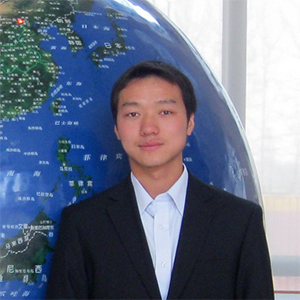
Dr. Song Gao is an Assistant Professor in Geographic Information Science at the University of Wisconsin-Madison, where he leads the Geospatial Data Science Lab. He holds a Ph.D. degree in Geography at the University of California-Santa Barbara (UCSB). His main research interests include Place-Based GIS, Human Mobility Big Data, and GeoAI for Social Sensing. He is the (co-)author of more than 50 peer-reviewed articles with over 2500 Google Scholar citations. He is the (co-)PI of multiple research grants from NSF, WARF, and Microsoft AI for Earth. He currently serves as the Associate Editor of Annals of GIS, Academic Editor of PLOS ONE, Guest Editor for IJGIS, and the Board Member of AAG Specialty Group in Geographic Information Science and Systems. He was the recipient of the ‘Waldo Tobler Young Researcher Award’ in GIScience, The U.S. Cartography and Geographic Information Society Doctoral Scholarship, the International Cartographic Association Scholarship, Jack & Laura Dangermond Graduate Fellowship, and UCSB Research Excellence Awards. He has a passion for connecting novel GIScience theoretical research to advancements in the geospatial industry for solving real-world challenges.
Dr. Daniel W. Goldberg is an Associate Professor of Geography and Computer Science & Engineering at Texas A&M University where he is also the Director of the TAMU Center for Geospatial Science, Applications & Technology (GeoSAT) and the TAMU GeoInnovation Service Center. Dr. Goldberg received his Ph.D. in Computer Science from the University of Southern California in 2010. His research encompasses a broad range of topics from spatial databases and geospatial health to geographic education to geocomputational approaches, most notably including geocoding techniques. He has served in geospatial leadership positions at the national level for UCGIS and USGIF and helps facilitate the largest GIS Day in the world, held annually at Texas A&M. In his free time, he likes digging in the dirt, being on or near the water, and snuggling his children while they are still young enough to allow it.
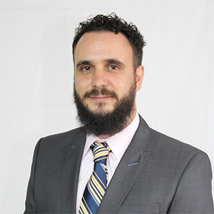
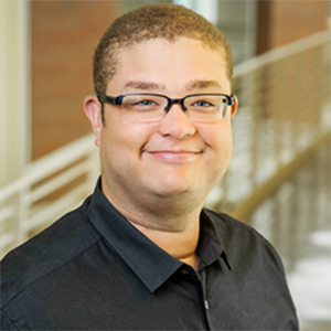
Dr. Andrew J. Greenlee is an Associate Professor in the Department of Urban and Regional Planning at the University of Illinois at Urbana-Champaign. Dr. Greenlee’s research lies at the intersection of housing policy, poverty, and social equity within cities and regions. His current research examines neighborhood and metropolitan opportunity structures through residential mobility processes including elective mobility and displacement. Greenlee’s other ongoing research examines the influence of governance on spatial outcomes for public and subsidized housing participants, and the dynamics of neighborhood change driven by urban renewal processes and public housing transformation. As an expert in housing policy, Greenlee has testified before the U.N. Special Rapporteur on Housing, and has provided technical assistance to fair housing advocates, states, and local governments.
Dr. Joseph Holler is an assistant professor of geography at Middlebury College. He earned his PhD in the geography and GIScience IGERT program at the University at Buffalo. Joseph’s doctoral work mixed qualitative methods, spatial analysis, and quantitative survey analysis to understand processes of adaptation to climate change at the household level in a coffee agroforestry system. As a GIS Teaching Fellow at Middlebury, he committed to learning and teaching open source GIS and open science. His research focuses empirically on social vulnerability and adaptation to hazards and climate change and methodologically on modelling social vulnerability and processes of planning and implementing adaptation at individual and national scales. Most recently, he has been replicating and reproducing geographic models of social vulnerability and attempting to validate them with new indicators of harm derived from surveys or from new sources of volunteered or crowd-sourced geographic information (e.g. Twitter or OpenStreetMap). He brings this interest in reproducibility and replicability of geographical science and background in mixed methods geographic research to the GSI COVID-19 Research Fellowship.
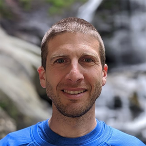
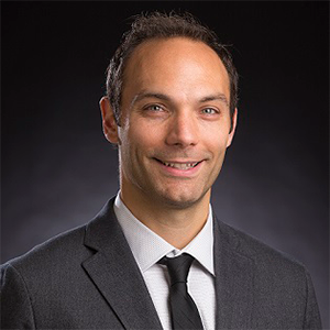
Dr. Naomi W. Lazarus is an Assistant Professor of Geosciences in the Department of Geography and Planning at California State University, Chico. She earned her B.A. and M.A. in Geography at Binghamton University, New York, and has a Ph.D. in Geography from the University of Connecticut, Storrs. Dr. Lazarus’ research examines the demographic, social, and economic impacts of natural and anthropogenic hazards. She incorporates spatial statistics and geographical information systems to develop spatial models to assess vulnerability and risk associated with environmental hazards and disease epidemics. Her current research examines spatial and temporal trends in the dengue virus in South Asia. Dr. Lazarus teaches courses in GIS, cartography, and quantitative methods at CSU Chico. She is the coordinator of the geospatial technology certificate program in her department and is a faculty advisor to GeoPlace, the student-run mapping lab at the university.
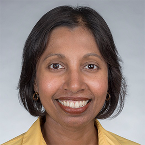

Dr. Kenan Li is a research scientist at the Spatial Science Institute of University of Southern California. He achieved his B.S. degree at Nankai University in China, an M.S. and Ph.D. degree at Louisiana State University, and his postdoc training at University of Southern California. His expertise focused on spatial computation and modeling of community resilience/sustainability, data science and statistics in environmental health, and geosimulation of human and environmental systems. His work incorporates big data, deep learning, and GIS, and seeks to develop geoAI (artificial intelligence) frameworks, integrated geo-cyber-infrastructures, new approaches for analyzing integrated sensor data, and novel biostatistics algorithms. He has a rich experience of leading various research projects funded by the National Science Foundation, National Institutes of Health, Bureau of Ocean Energy Management, U.S. Department of Agriculture, and U.S. Army Corps of Engineers.
Ruby Mendenhall is an Associate Professor of Sociology, African American Studies, Urban and Regional Planning, Gender and Women’s Studies and Social Work. She is an affiliate of the Carl R. Woese Institute for Genomic Biology; Women and Gender in Global Perspectives; the Cline Center for Advance Social Research; Epstein Health Law and Policy Program; Family Law and Policy Program and the Institute for Computing in Humanities, Arts and Social Sciences. Mendenhall is the Assistant Dean for Diversity and Democratization of Health Innovation at the Carle Illinois College of Medicine. Mendenhall’s research examines how living in racially segregated neighborhoods with high levels of violence affects Black mothers’ mental and physical health using surveys, interviews, crime statistics, police records, data from 911 calls, art, wearable sensors and genomic analysis. She employs big data to recover Black women’s lost history using topic modeling and data visualization to examine over 800,000 documents from 1740 to 2014.

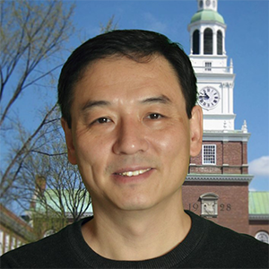
Dr. Xun Shi is a Professor of Geography at Dartmouth College. He received his Ph.D. from the University of Wisconsin-Madison in 2002, M. Phil from the University of Hong Kong, MS from the Chinese Academy of Sciences, and BS from the Peking University. He has been highly active in the area of health-related geospatial research. His research covers disease mapping, disease-environment association detection, communicable disease modeling, healthcare access assessment, and geomasking. He received funding supports from NIH, NSF, USDA, and other sources, and has been collaborating with scholars and practitioners in environmental health, children’s health, communicable disease control and prevention, and healthcare services. He published more than 70 research papers in international journals, and developed ArcHealth, a software package serving spatial analytical functions particularly requested by health-related studies and practices. He served as the Chair of the Health and Medical Geography Spatiality Group of American Association of Geographers (AAG) during 2015-2016, and as an editor of AAG Annals during 2008-2018.
Dr. Daoqin Tong is an Associate Professor in the School of Geographical Sciences and Urban Planning at Arizona State University. Her research interests include spatial data analysis, spatial optimization, and geographic information science to improve spatial decision-making. She developed models and solution algorithms to solve real-world problems spanning location analysis, food access, transportation, and public health. Recently, she has examined issues related to urban sustainability. She developed analytical approaches to examine the potential of sustainable urban agriculture through the integration of renewable water resources. She has also worked on the optimal placement and design of green infrastructures to mitigate the impacts of urban flooding. Another ongoing project explores how pollen can be used for tracking the movement of objects and people through space and time. Her work has been funded by multiple government agencies (e.g., NSF, DOD, and DOT) and local organizations.
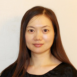

Dr. John P. Wilson is Professor of Architecture, Civil and Environmental Engineering, Computer Science, Preventive Medicine, Sociology and Spatial Sciences at the University of Southern California where he directs the Spatial Sciences Institute and the Wilson Map Lab. He also serves as the Co-Director of the Climate and Health Working Group, the Exposure Sciences Research Core, and the External Factors Facility Core in the Southern California Environmental Health Sciences Center, and as the Spatial Sciences Lead in Clinical Research Informatics Core within the Southern California Clinical and Translational Science Institute. He is the editor-in-chief of the journal Transactions in GIS (Wiley-Blackwell) and the Geographic Information Science & Technology Body of Knowledge 2.0 (University Consortium for Geographic Information Science). His research focuses on the modeling of human and environmental systems and makes extensive use of GIS, spatial analysis, and various forms of environmental modeling. He has published numerous books and articles on these topics, including Environmental Applications of Digital Terrain Modeling (Wiley-Blackwell, 2018) and two edited volumes, Terrain Analysis: Principles and Applications (Wiley, 2000) and the Handbook of Geographic Information Science (Blackwell, 2008). Much of this work is collaborative with the goal of improving our understanding of the factors connecting people, their environments, and their well-being.
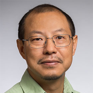
Dr. Ningchuan Xiao is a Professor of Geography at The Ohio State University. He is interested in spatial data science. He has a specific interest in the development of effective computational methods for mapping and analyzing spatiotemporal data, and for solving spatial optimization problems. He has an extensive research and teaching portfolio that includes cartography and visualization, web-based mapping, spatial analysis and modeling, spatial decision support systems, and environmental modeling.

Copyright © CyberGIS Center. All rights reserved.